

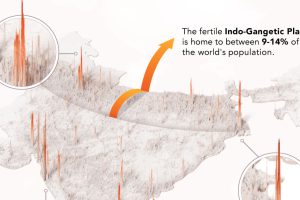
India’s population density averages at around 1,100 people per square mile. But that number can jump much higher in certain cities. Read more

In this 3D visualization, we show the population density of France, highlighting how Paris is the most densely populated area in Europe. Read more

As one of Europe’s most densely populated countries standing at 83.8 million inhabitants, we show the population density of Germany. Read more

This animation shows the population density of U.S. counties between 1790 and 2010, showing the westward expansion of the country’s population. Read more
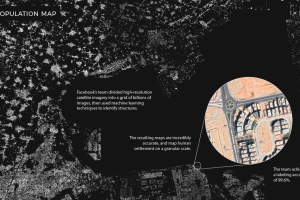
Machine learning technology is allowing researchers at Facebook to map the world population in unprecedented detail. Read more
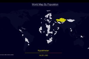
Watch countries appear one-by-one to form a cohesive world map, when they are ordered by population. Read more
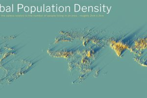
What does population density look like on a global scale? These detailed 3D renders illustrate our biggest urban areas and highlight population trends. Read more

This 3D map shows the population density of the UK, highlighting how London and South East England house 27% of the total population. Read more
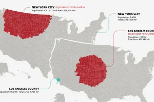
The U.S. population is spread across a huge amount of land, but its distribution is far from equal. These maps are a unique look at population density Read more
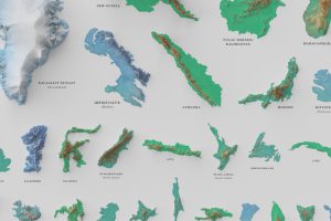
See the world’s 100 biggest islands in a side-by-side comparison. Then, we look to see which islands have the highest population densities. Read more